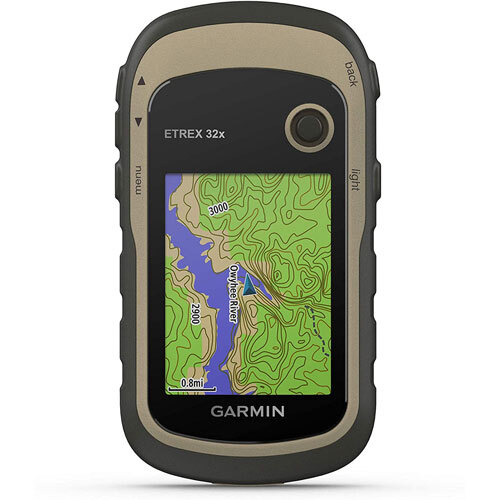
About Garmin eTrex 32x
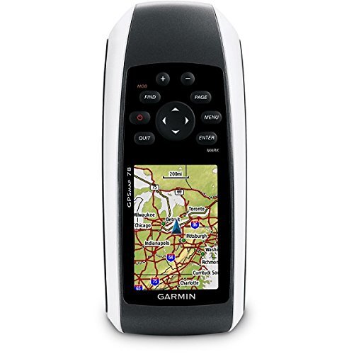
Spotlight on a venerable best-seller: the Garmin eTrex 32x, your premier handheld GPS navigator. Designed for both recreational and professional use, this device features optimum storage-2000 waypoints, 200 routes, and 200 saved tracks with a 10,000-point track log. Rated IPX7 for waterproof reliability, its sunlight-readable 2.2-inch display, 3-axis compass, and barometric altimeter ensure you stay oriented in any condition. With preloaded TopoActive Europe maps and GNSS support (GPS, GLONASS), experience up to 25 hours of precision navigation. Try now and discover navigation excellence!
Garmin eTrex 32x Features & Versatile Applications
The eTrex 32x distinguishes itself with premier features such as a sunlight-readable color display, 3-axis compass, barometric altimeter, and rugged waterproof body. Its application areas span outdoor navigation, hiking, cycling, geocaching, and even professional fieldwork. Supported on various surfaces-from mountain trails to urban environments-this versatile GPS navigator is tailored for adventure seekers and professionals requiring precision and dependability in every journey.
Supply Ability & Sample Availability of Garmin eTrex 32x
The Garmin eTrex 32x is handed over efficiently with strong supply ability across India. Sample units are available, enabling buyers to assess the model before significant expenditure. Our sample policy is transparent-samples are available on request, with minimal freight charges applicable. This ensures clients receive prompt, cost-effective access to evaluate suitability while minimizing unnecessary financial outlay.
FAQ's of Garmin eTrex 32x:
Q: How do I operate the Garmin eTrex 32x for outdoor navigation?
A: Simply power on the unit using two AA batteries, utilize the keyed interface and joystick for menu navigation, and select your desired mapping option or activity mode. Its straightforward controls make it user-friendly even for beginners.
Q: What sensors are integrated in the Garmin eTrex 32x, and how do they enhance usage?
A: The eTrex 32x includes a 3-axis compass and a barometric altimeter, offering enhanced orientation, altitude accuracy, and reliable readings during hiking, cycling, or exploring diverse terrains.
Q: Where can the Garmin eTrex 32x be effectively used?
A: This premier device is perfect for outdoor applications such as hiking, cycling, geocaching, field surveying, and recreational navigation, adaptable to mountain, forest, or city environments.
Q: What is the process for obtaining a sample Garmin eTrex 32x?
A: To request a sample, contact the supplier directly. After minimal freight charges are settled, the sample unit will be promptly handed over under the policy terms.
Q: What benefits does the waterproof (IPX7) rating provide to users?
A: The waterproof rating ensures the eTrex 32x remains functional in heavy rain, accidental submersion, and wet conditions, supporting reliable performance in diverse outdoor environments.
Q: How accurate is the GPS on the Garmin eTrex 32x?
A: The device provides GPS accuracy of less than 10 meters (typical), ensuring reliable, pinpoint position tracking, critical for navigation, wayfinding, and professional fieldwork.


 Send Inquiry
 Call Me Free